|
Morocco:
Moyen Atlas Mountains Bicycle Africa / Ibike Tours |
|||
 |
East of the Atlas: Ziz River and Haute Atlas | ||
| Topography from Errachida to Er Rich. This section cross both the Haute (High) Atlas. The average slope is 1.5%, the maximum slope riches 5% in a few sections. | |||
 [Depending upon the quality of the underlying data graphs maybe only general representations of the topography.] |
|||


 |
|||
|
Ten kilometers north of Errichidia, at the foot hills of the Haute Atlas
Mountains, is Al Hassan Ad Dakhil dam and reservoir. The dam was built
between 1968 and 1971 for the purpose of storing water for irrigation and to
prevent seasonal down stream flooding. The reservoir is about 7 kilometers long.
When the lake is full, it backs up the Ziz River at least as far again.
Al Hassan Ad Dakhil, the name sake of the dam and lake, was a direct ancestor to Sharif ibn Ali the founder of the Alaouite Dynasty, the current royal family. Al Hassan Ad Dakhil was brought to Morocco from Yanbu, a port on the west coast of Saudi Arabia, at the end of the 13th century by the inhabitants of Tafilalet (a large oasis to the south on the Ziz River) to be their Imam. They were hoping that, as he was a descendant of the Prophete Muhammad, his presence would help to improve their date palm crops thanks to his barakah (an Islamic term meaning a sense of divine presence or charisma). |
|||
 |


 |
 |
|

|
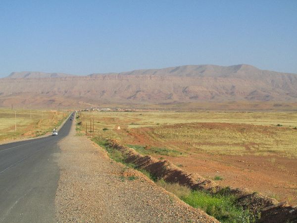
The Ziz River's headwaters are about 40km northwest of Er Rich. From the
reservoir to Kerrandou (40km), the Ziz River has cut a steep sided valley
through the mountains. It is generally most picturesque and dramatic when it is
narrow, but there are views of grand spaciousness and framing where the valley
broadens out. Every curve in the road introduces a different combination of
remarkable shapes, textures and colors to admire. The valley is often green on
the bottom and various shades of gray, yellow and red on the sides.
Berber liberation graffiti, The Zaabal Tunnel, and snow capped mountains
(lower right) offered other changes of focus. |

|
|
 |

 
 |
 |
|
| Er Rich is a small town with a large presence, relaxed atmosphere and ample composition for photography: | |||
 |


 |
 |
|

|
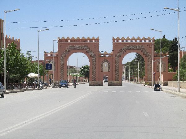
 The
entrance to the town center is marked by sturdy dual arches that let you know
you had arrived. The buildings in the town center are compact two and
three-story structures. There is the dramatic back drop of the Atlas Mountains
is visible from many parts of town. The market is large enough but not so large
as to be incomprehensible. ("When is all this stuff ever going to sell?"). A
nice assortment of café and eateries caters to the
range of desire from coffee, fresh juice, tajine, a more extensive prepared
meal, pastries and desserts. For a variation of an approach, the cage-free live
chickens are living cage-free, with feeding towers and water, in the whole shop
space (left). In keeping with the temperament of town -- or maybe it was just
slow midday -- the attendant at a women's dress shop had his feet up and was
enjoying something that made him happy through his headphones. A couple of
moments that got captured are beehives for sale, a bicycle (and trailer) vendor,
and an afternoon in the park playing botchy ball. The
entrance to the town center is marked by sturdy dual arches that let you know
you had arrived. The buildings in the town center are compact two and
three-story structures. There is the dramatic back drop of the Atlas Mountains
is visible from many parts of town. The market is large enough but not so large
as to be incomprehensible. ("When is all this stuff ever going to sell?"). A
nice assortment of café and eateries caters to the
range of desire from coffee, fresh juice, tajine, a more extensive prepared
meal, pastries and desserts. For a variation of an approach, the cage-free live
chickens are living cage-free, with feeding towers and water, in the whole shop
space (left). In keeping with the temperament of town -- or maybe it was just
slow midday -- the attendant at a women's dress shop had his feet up and was
enjoying something that made him happy through his headphones. A couple of
moments that got captured are beehives for sale, a bicycle (and trailer) vendor,
and an afternoon in the park playing botchy ball. |

|
|
 |


 |
 |
|
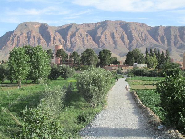
| The higher elevation, cooler temperature and more available water, brought by the Ziz River from the Atlas, must play a part in greening up the valley and increasing the farming. | |||


 |
|||
  The
fertile valley was short lived. In the broad, flat areas, agriculture gave way
to scrub brush. The
fertile valley was short lived. In the broad, flat areas, agriculture gave way
to scrub brush.Where the valley became narrower, the hills are to steep to
hold enough moister to support much vegetation, and the valley flow is consumed
by the Ziz river when it is in flood and pretty much scoured of vegetation. |
|||
  When
the Ziz River is not in flood it makes a very good highway for donkey transport. When
the Ziz River is not in flood it makes a very good highway for donkey transport.One of the realization of watching donkeys is appreciating the range of personalities they have. Some are very cooperative and at the other extreme some animals seem to have as their purpose in life to do anything except that which is asked of them. |
|||
 |
|||
|
|
Unique Programs To Special Places For Memories Of A Lifetime!
"Hosted by
DreamHost - earth friendly web hosting"
|
|